
Barr na Coilleadh [Barnacuillew] [Barnacuille]
Good walks are even better shared.
Overview
Barr na Coilleadh (Barnacuillew)
Nestled in the scenic landscape of the Scottish Highlands, Barr na Coilleadh, or Barnacuillew, is a Marilyn that attracts hikers keen to explore its rolling slopes and grab some sweeping views from its summit. At a respectable height of 559 meters, it’s not the tallest in the region, but what it lacks in height, it makes up for in beauty and accessibility.
Geology
This mountain is primarily composed of schist and granite. Its rocky outcrops bear witness to the harsh elements, while the glacial sculpture of valleys and peaks in the area provides a lurking reminder of the ancient ice age. Hiking here is a bit like walking through a geological museum!
Routes
There are multiple routes available to reach the summit, with the Glascarnoch Dam Start being the more commonly chosen path. This route is scenic, roughly 6.5 km long, and will take about 3.5 hours of moderate hiking. If you're feeling adventurous, the Inverlael Start gives you a longer trek of about 10km, ideal for those looking to challenge themselves.
Summit Features
Reaching the top rewards you with a stone cairn and a trig point — perfect for the proverbial 'I was there' snapshot to impress your non-hiking friends (who may not believe you anyway!).
Terrain Type
Expect a delightful mix of rocky pathways and grassy slopes. It can be muddy after rain, so sturdy boots are your best friend. The terrain ranges from gentle inclines to sections that might ramp up your heart rate a tad.
Views
The views from the top are nothing short of exceptional. On a clear day, you’ll be treated to panoramic scenes of Ben Wyvis and the Fannichs. Try to visit in late spring or early autumn for the most splendid views — don't forget your camera!
Hazards
Weather in the Highlands can be as fickle as a cat on a hot tin roof, so be prepared for sudden changes. Slippery rocks and boggy patches can add to the adventure, but care is always recommended to avoid mishaps.
Access
The Glascarnoch Dam car park is the most convenient starting point for your hike. The nearby town of Garve is ideal for grabbing any last-minute supplies or a hearty meal post-hike.
Facilities
Though the mountain is in a wild area, Garve graciously offers nearby facilities, including cafes for topping up on energy and toilets for your convenience.
History
Barr na Coilleadh, meaning 'Top of the Wood', hints at the lush forests surrounding it. Historically, this area has served local communities for centuries, making it a significant landmark in the region.
Now that you’re armed with knowledge about Barr na Coilleadh, lace up those boots and enjoy the great outdoors! You'll discover that hiking here is not just exercise; it’s truly a splendid way to connect with nature.
Happy hiking!
Explore routes near Barr na Coilleadh [Barnacuillew] [Barnacuille]
Public walks starting within 80 km of this hill. Nearby does not mean a route reaches the summit; check its map and access before setting out.
No public routes are currently listed within 80 km of Barr na Coilleadh [Barnacuillew] [Barnacuille] on Walkmates. This does not mean there are no paths here. Explore the map and check local access information before planning a walk.
Route planning notes
These notes describe possible approaches, not verified navigable routes or permission to cross land. Check current paths, local access rules and conditions before setting out.
Glascarnoch Dam Start
A popular route starting near Glascarnoch Dam, leading through beautiful forested areas before ascending towards the mountain's summit.
Inverlael Start
An alternative route that winds through scenic glens and offers a longer trek, taking you over various terrain types before reaching the summit.
Make a day of it, together
Find someone to share the walk with, or organise a day out along a route you like.
Hill facts and local notes
Classifications
Elevation
264m
866 ft
Prominence
240m
Coordinates
54.2725, -9.8274
F810375
OS Map
22
At the Summit
The summit features a prominent trig point and a small stone cairn, ideal for your obligatory summit selfie and perhaps a cheeky snack break.
Terrain & Geology
The mountain primarily consists of schist and granite, providing a stunning contrast against the lush greenery of its surroundings. The erosion patterns here tell tales of ancient glacial activity, leaving behind the iconic rugged terrain.
Views & Scenery
From the summit, one can behold panoramic views of the surrounding hills, lochs, and valleys, including glimpses of the majestic Ben Wyvis and the distant heights of the Fannichs.
History & Heritage
Name Origin
The name 'Barr na Coilleadh' translates to 'Top of the Wood', which hints at the lush forests that surround it.
Historical Significance
Historically, the mountain has been a notable feature for local communities, often traversed by cattle and sheep herders who’ve traversed its slopes for centuries.
Getting There & Facilities
Check current local access restrictions, parking rules and transport timetables before travelling. These notes do not confirm public access to the summit.
Parking
Parking is available at Glascarnoch Dam car park, which is well-signposted and offers ample space for vehicles.
Public Transport
Limited public transport is available; the nearest bus stops are in Contin, but be sure to check local schedules.
Nearby Facilities
While the mountain is rugged and wild, Garve offers essential facilities, including cafes and toilets. A quick stop at the local shop can stock you up on snacks for your journey.
Safety Information
Known Hazards
- Be mindful of slippery rocks, especially after rain. The area can also be prone to sudden changes in weather, so pack a waterproof jacket!
General Safety Tips
- Check weather conditions before setting out
- Carry appropriate clothing and equipment
- Let someone know your planned route
- Take a map, compass, and GPS device
- Carry emergency supplies: food, water, first aid kit, torch
Hills
Some common questions about the hills answered
Are there group walks up Barr na Coilleadh [Barnacuillew] [Barnacuille]?
Many walkers use Walkmates to join or organise walks with others. You can check for group walks around Barr na Coilleadh [Barnacuillew] [Barnacuille] through the maps
Are there other walkers around Barr na Coilleadh [Barnacuillew] [Barnacuille]?
Activity varies by location and time, but Walkmates lets you see whether others have shared walks or shown interest in this area. Find other people through the walking friends search walking friends for Barr na Coilleadh [Barnacuillew] [Barnacuille] search or of course create your own walk for Barr na Coilleadh [Barnacuillew] [Barnacuille]
Can I organise a walk to Barr na Coilleadh [Barnacuillew] [Barnacuille]?
Yes. If there aren’t any walks listed already, you can create a walk and make it available for others to join.
If you're signed up to Walkmates, you can create a walk to Barr na Coilleadh [Barnacuillew] [Barnacuille].
How do I find a walk up this hill?
There are often multiple ways to walk this hill, depending on experience and route preference. Walkmates helps you explore walks and routes that others have shared.
Can I suggest a new route up Barr na Coilleadh [Barnacuillew] [Barnacuille]?
Yes. You can suggest or create routes to share with others. Walkmates focuses on the social side of walking, so routes are used to help people organise walks and explore areas together, rather than as detailed navigation tools or route libraries.
Other uses really appreciate knowledgeable walkers sharing their routes. Share your favourite route to Barr na Coilleadh [Barnacuillew] [Barnacuille] here
The is an error or something incorrect about this hill. How do I let you know?
We always strive to keep the information on Walkmates as accurate as possible. If you find an error, please let us know through the contact form and we'll aim to correct it as quickly as possible
Community Discussion
Comments
Location
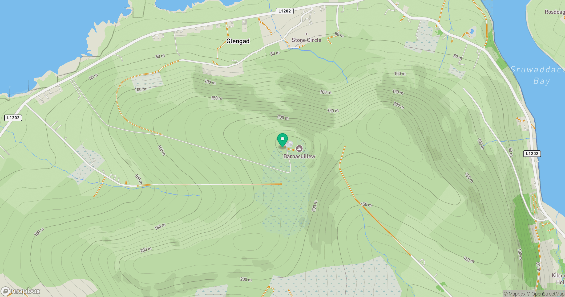
Grid reference: F810375
View on OpenStreetMapOpens a map in a new tab, centred on the hill.
Hills within 30 km
Straight-line distance, not a walking route or confirmation of access.
No comments yet. Be the first.